July 20 and August 17 (Saturdays)
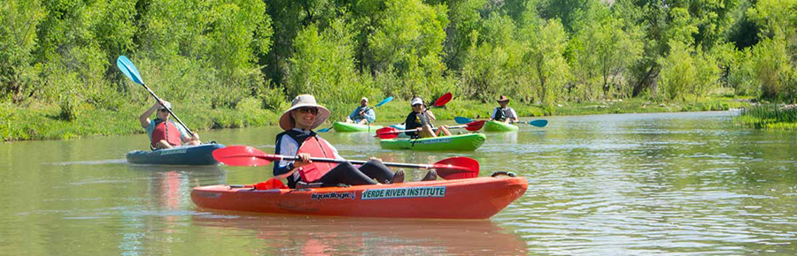
The AHS Phoenix Chapter is planning two float trips on the Verde River in conjunction with the Verde River Institute (VRI). This interpretive float will be along a stretch of river near Clarkdale, from the Tapco River Access Point to the Tuzigoot River Access Point, about 3.5 miles. This stretch of river will be impacted by the removal of the Brewers Tunnel Dam (see below), so this is an exciting time to be on the Verde!
- Dates: July 20 and August 17
- Trip length: 4.5 hours
- Maximum attendees: 16 per trip, first-come, first-served
- What’s provided: Boats, PFDs, paddles, dry bags
- Suggested donation: $60/person
You’ll need to sign up on our site first and then go to the VRI website to make your donation and download forms and trip info.
Sign Up for the July 20 Trip | Sign Up for the August 17 Trip
The Removal of the Brewers Tunnel Dam on the Verde River: What it means for the environment and its stakeholders
—3/15/19, Verde River Institute
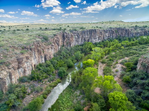
On February 15, 2019, a momentous occurrence happened on Arizona’s Verde River in the Town of Clarkdale. On that day, the Brewers Tunnel diversion dam, a 105-year-old steel dam, was breached. A springtime flood of approximately 16,000 CFS (normal winter base flow here is about 75 CFS) damaged a formerly patched part of the dam near its western end, and 25 feet of the 300-foot dam collapsed. The collapse resulted in the draining of a 3200-foot long pond above the dam. On February 26, the owner of the dam, the mining giant Freeport McMoRan, announced to the Town of Clarkdale that the dam would not be repaired, and that they would remove it completely as soon as practical.
This decision was one of the most important single decisions ever in the history of Verde River management and conservation. The Verde River Institute Board of Directors has designated the monitoring and documentation of the impacts of this decision as the most important goal for the organization this year. With that in mind, we will dedicate our research and monitoring resources to understanding the benefits of dam removal on the Verde River’s flows, water quality, and ecosystem health.
Beginning the day of the breach, we started daily photographic monitoring of the site to document the changes in the river’s form and physical response to the dam breach. We also flew a photogrammetric mission over the area to capture hi-resolution 2D images as well as elevational and 3D modeling of the site immediately after the breach. The results of that modeling can be seen here.
Then, having observed the “birth” of a new 500-foot riffle in the upper reaches of the previous pond, and based on the understanding that riffles are the most productive habitats in the river, we created a sampling plan for the rapid. That plan divides the riffle into 5 100-foot sections. Each section will be surveyed to obtain stream bottom profiles, then each will be periodically sampled to understand the aquatic macroinvertebrates in the riffle. These data are useful in quantifying the amount and quality of life that the riffle will support.
The described projects will allow the Verde River Institute and other stakeholders understand the impact that dam removals can have on the Verde River’s water provision to downstream users, ecosystem health, water quality and ability to “heal” after a dam is removed.
An opportunity to study a dam’s removal and its impact comes along only a few times in a lifetime, and we are here to make sure that the data and analysis of this dam’s passing are well documented and understood.
We would like to ask for your support in this effort by volunteering, donating or providing expert advice and assistance. If we all work together, we can write an important new chapter in how the Verde River works, how its ecosystems change, and how dam removals may improve the river’s flows, so that downstream habitat and users are better served.