Pima County Regional Flood Control District Monthly Brown Bag Series
Speaker: Kenneth Maits, Program Manager – Pima County Regional Flood Control
Date / Time: Wednesday, April 11, 12:00 – 1:00 PM
Location: 201 North Stone Ave, 9th Floor
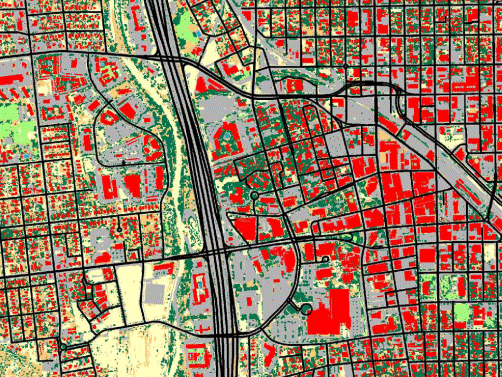 PC-RFCD in cooperation with Babbitt Center for Land and Water Policy, the Chesapeake Conservancy, and Pima Association of Governments has completed a project to produce a land-use-land-cover (LULC) dataset for approximately 3700 square miles in eastern Pima County. The presentation will discuss the process used to produce this dataset, the challenges encountered during production, and the accuracy and applicability of the data. Additionally the presentation will examine projected uses for the information and additional improvements to the data being considered.