Landslides of the Agua Fria Canyon/Black Canyon City area
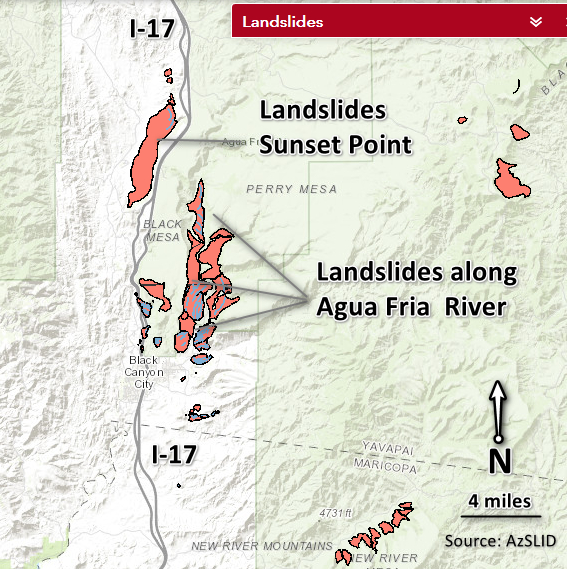
This is the first of several blog posts profiling the work of AZGS geoscientists as they map and investigate landslides along Interstate-17 (I-17) from Anthem (25 miles north of Phoenix) to Flagstaff. This is a preliminary report and has not been reviewed for AZGS editorial standards. AZGS will release an Open-File Report with data, digital maps, and final results later this year.